BEST OF SANTORINI ISLAND HOLIDAYS | MEMBER OF SANTORINI® WEB
More Villages in Santorini Island
| More Villages in Santorini : |
| Photo : Klearchos Kapoutsis |
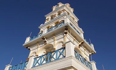
| Emporio : Also Known as Nimborios |
| Emporio is the largest village of Santorini. It can be found in a central southern location 12 kilometers from
Fira at the foothills of Profitis Ilias Mountain. Emporio is a traditional settlement and one of the five fortified castles
in Santorini, the Goulas of Nimporio.
In Medieval times, the inhabitants used to build their houses side by side, so that they could protect
themselves against the pirates. Just before the entrance to the village is the church of
Agios Nikolaos Marmaritis.
There are different theories about the origin of the name Emporio. The prevailing idea is that the name came from 'emporio'
= trade, because the settlement was the center of buying and selling all kinds of merchandise, due to the geographical
proximity of the mercantile port of Ancient Elevsina.
Above Emporio one can see the mountain ridge of Gavrilos, where ruins dating to the Byzantine period have been discovered.
As you drive to Emporio from Fira, you can spot eight windmills on the right hand side of the road. |
|
| Photo : Klearchos Kapoutsis |
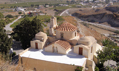
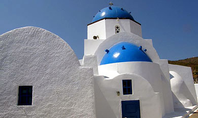
| Episkopi Gonia : Also Known as Mesa Gonia |
Episkopi Gonia can be found at the foothills of Profitis Ilias Mountain on the way to Kamari, 6 kilometers
from Fira in the south eastern region of Santorini. The village is called known as Mesa Gonia, since that
was its official name until 1915. Mesa Gonia used to
be in important area for producing wines.
On old maps it is also referred to as 'Kato Gonia'
(Kato Gonia = The Corner Below). Episkopi Gonia received
its name due to the proximity of the Byzantine church
Koimisis of Theotokou, also known as Panagia
Episkopi.
History records that the church was the headquarters
of both the orthodox and later the Latin bishop on the
island. Episkopi Gonia was almost completely destroyed
during the earthquake of 1956, and most of the inhabitants
moved to Kamari. |
|
|
| Photo : Klearchos Kapoutsis |
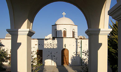
| Agios Georgios : |
| Agios Georgios village owes its name to the church
of Agios Georgios Thalassinou = Saint George of the Sea, otherwise
known as Thalassiti = Mariner, which was built over the foundations
of large basilica. The village belongs to the community of Emporio,
14 kilometers from Fira on the south east coast of Santorini
near to Perivolos.
Well known is the beach
of Perivolos - Agios Georgios. |
|
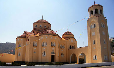
| Exo Gonia : |
| Exo Gonia village is on the way to Kamari, 8 kilometers from Fira in the south eastern region of
Santorini. Older maps refer to it as 'Apano Gonia' (Apano Gonia = The Corner Above). High up on the hill one can
find the Church of Agios Charalambos, which is one of the three largest churches in Santorini. The beach of
Exo Gonia is 2,6 kilometers from the village. It is called
Avis beach, after the AVIS Tomato Canning Factory that used to be there. |
|
|
| Photo : Klearchos Kapoutsis |
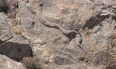
| Exomitis |
| Exomitis (in earlier days it was known as Exemiti) is both a cape and a village on the southern coast of Santorini
near to Perissa. The village belongs to the community of Emporio. On the rocks to right hand side of the road from Perissa going
towards Exomiti, there are ancient tombs. One of the rocks has a carving on the tombstone of a huge viper, the 'Oxentra' or
'Exentra' which is Ancient Greek for 'Oxia" = viper. The port of Ancient
Elevsina is thought to be near to the Akrotiri of Exomiti. |
|
| Photo : Klearchos Kapoutsis |
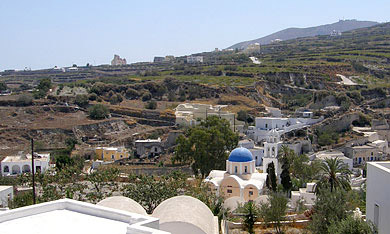
| Panagia Kalou |
| Panagia Kalou is 8 kilometers north east
from Fira. The village belongs to the community of Imerovigli.
The village takes its name from the Church of Panagia
tou Kalou otherwise known as Koimisis of Theotokou. Panagia
tou Kalou means Holy Virgin of the Good. The church was
built when 'O Kairos tou Kakou' = The Time of Evil was
over, in other words the seismic activity during the period
of 1649 until 1650. The result of this activity was the
appearance of the submarine
volcano in Kolumbo. |
|
|
| Photo : Klearchos Kapoutsis |
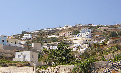
| Vothonas |
| Vothonas village is 3,3 kilometers from Fira, just
up and next to Messaria.
Vothonas is built within a gorge, while many of the original
dwellings are cave houses that have been dug into the volcanic
rock. You will find the Church of Panagia of Trypa and the Church
of Agia Anna. |
|
| Photo : Klearchos Kapoutsis |
| Vourvoulos |
Vourvoulos village is 3,7 kilometers approximately
from Fira going north east. Below the village is a majestic
view of the eastern plains, the coastline of Santorini,
Vourvoulos
beach, the northern coastline, and the beaches of
Pori and Koloumbo. Vourvoulos means 'fouskala' = bubble
or blister, and it is said to have got its name from
curious shaping of the terrain in the area, which due
to its volcanic origin is geologically pustular.
Within the village a monument has been erected to honour
those who died in the Secong World War during German
occupation. You will also find the Church of Agios Eftstratios
and Church of Agios Panteleimonas.
|
|
|
|